
Know Before You Go!
Welcome to the Arizona Backcountry Explorers wildfire information page. Here, you will find information about wildfires in Arizona and across the US.
If you are looking for fire restrictions, view our new interactive fire restrictions map
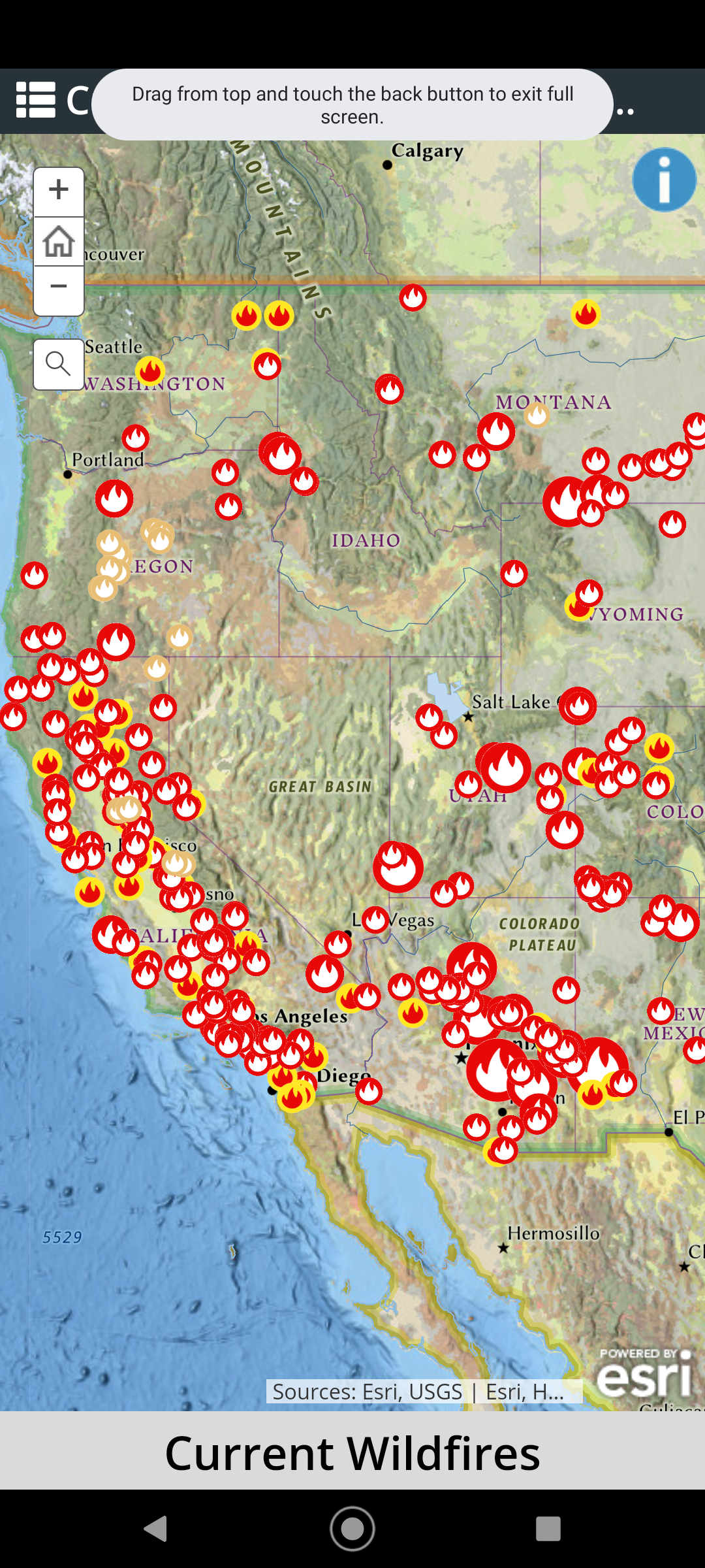
Our interactive wildfire map provides real-time information about current wildfire activity in the United States. Our map, updated frequently with data from the National Interagency Fire Center and NASA, offers a comprehensive view of wildfires to help you plan and stay safe.
Please remember that the information on the map, while sourced from reliable state and federal agencies, should be independently verified for accuracy.
More information on wildfire can be found at the links below.
National Interagency Fire Center
Arizona Department of Forestry and Fire Management
Inciweb
There are 26 fires currently burning in Arizona, burning a total of 13,627 acres.