

Another productive meeting to discuss the Apache Trail State Route 88
Another productive meeting concerning the Apache Trial commenced between the concerned individuals. We were able to bring in several new pro-motorized access faces. Pinal County hosted the forum with Supervisors Jeff Serdy and Mike Goodman. The Tonto National Forest District Ranger Matt Lane attended the meeting in person while the legislative liaison of the Arizona State Parks and Trails and a representative from the State Historic Preservation Office attended our meeting via a video conference call.
Whats next
We are moving this effort to the next level and hope to plunge this issue into the middle of the political sphere. Over the next few months, our goal will be to engage as many political representatives from every town and city in the vicinity to weigh in on this issue. Our Apache Trail Committee will be reaching out to them with details. At the same time, we will simultaneously ask members of the public to call their political representatives and request that they join us.
We have already allowed the public to make considerable noise, and this issue has made it on the desk of dozens of elected officials across the state. Our goal is to gain more leverage on the governor to express how important this issue is to the surrounding communities.
A letter signed by multiple political representatives, including Mayers, City Council Members, County Representatives, and State Legislators, will be sent to the Governor’s Office urging him to initiate the required studies to reopen the road. Likewise, we are assuring this issue will carry on to the next governor and their appointees after the 2022 election. Redistricting is also changing the Congressional district of the Apache Trail, making Andy Biggs the new congressional representative.
Additionally, a bill is currently working through the capital to split Maricopa County into four different counties. This allows us to work with new county representatives with jurisdiction over the Apache Trail who hopefully care about these issues. We must adjust to these changes and include these new representatives in this process.
Organizers will be erecting a billboard in Apache Junction, driving awareness towards this issue. There is currently a billboard in place driving traffic to a change.org petition. However, this new billboard will direct traffic to a new website laser-focused on engaging the public with the Apache Trail issue and sending emails to multiple decision-makers across the state.
The State Historic Preservation Office (SHPO) is ready for construction.
In our last update on the Apache Trail, we described the position of the State Historic Preservation office. In that update, we expressed SHPO’s position from the perspective of a long-time Archeologist who has been dealing with the historic preservation of the Apache Trail for several years. He is by far the most vested individual in state government who has knowledge of the Apache Trail, and his input has been considered.
Nonetheless, in our most recent meeting, a different State Historic Preservation Office representative surprised our group, firmly asserting historic preservation is not an obstacle for ADOT. According to SHPO, the Arizona Department of Transportation has not discussed the Fish Creek section of the Apache Trail with them at all.
SHPO argues that documented history such as a book about the Apache Trail could be considered “mitigation.” It would give ADOT the OK to make improvements that make the road safe without the interference of historic preservation. Furthermore, it would make the road ineligible for federal designations under the National Preservation Act, thus removing federal oversite of a state-owned RS2477 Right-Of-Way. Of course, our group must hurtle other obstacles, but for now, we know SHPO is ready to continue with the Apache Trail project.
It’s important to understand that the State Historic Preservation Office is not a regulatory body. They consult with state agencies and individuals while improving historical properties and provide insight into preserving the historical aspects of said properties. They have no regulatory authority to force ADOT to do anything. SHPO obtains much of its power from the National Preservation Act, a non-binding federal law that promotes the preservation and recognition of historic properties and places. They work hand in hand with the National Park Service to list historic properties in the National Register of Historic Places.
Please send the letter and show your support for our action.
2138 emails sent.
Tell the Arizona Department of Transportation and the Arizona Governor to reopen Apache Trail
Recap
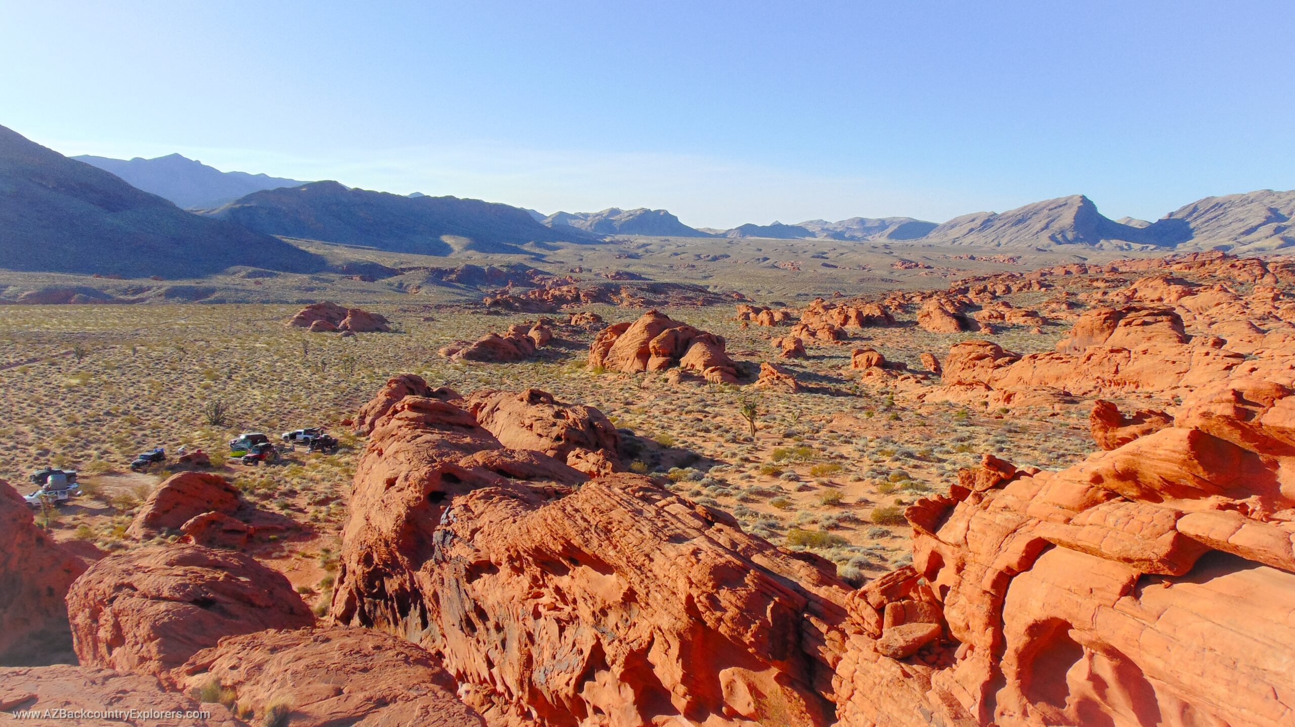
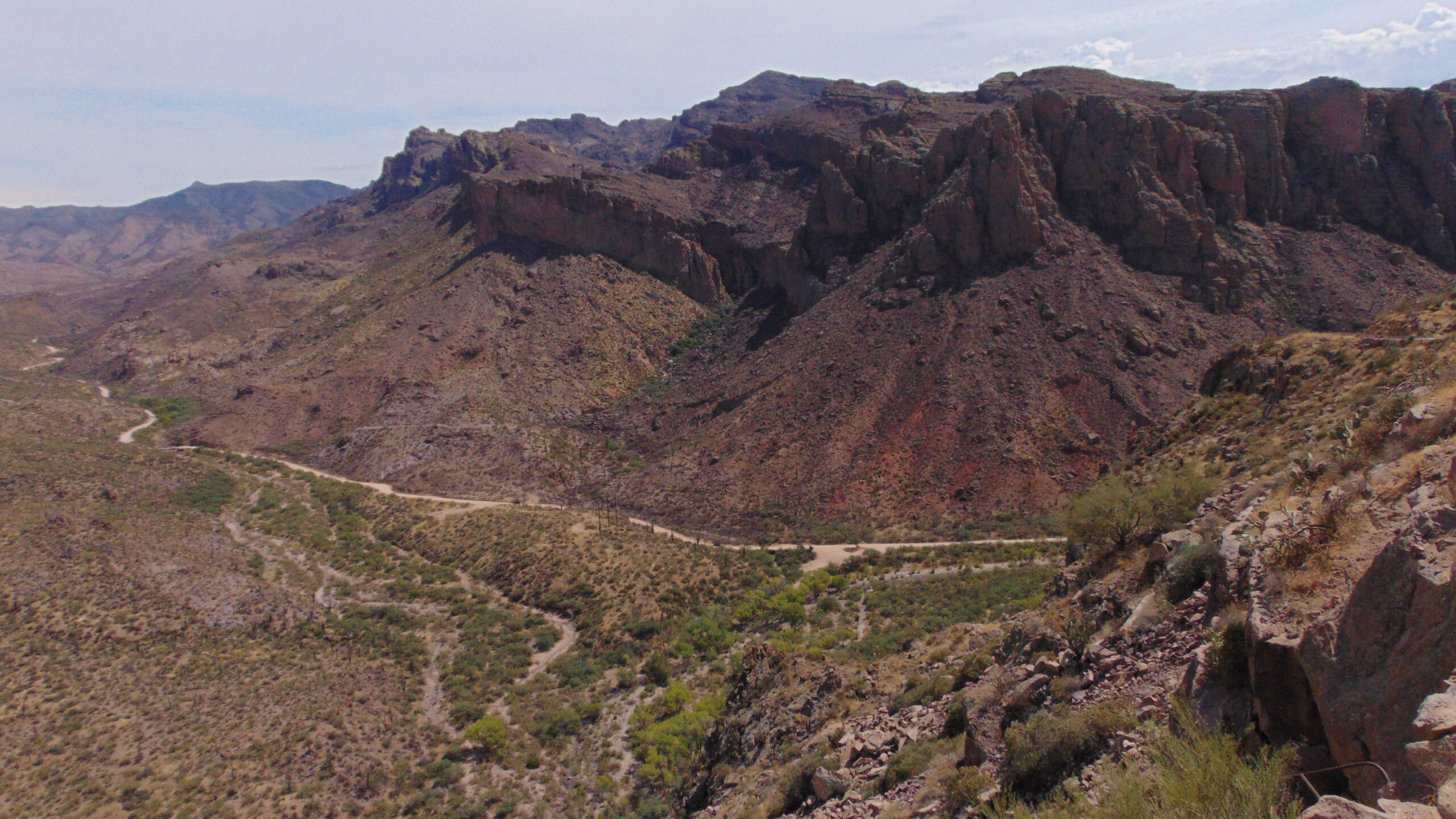
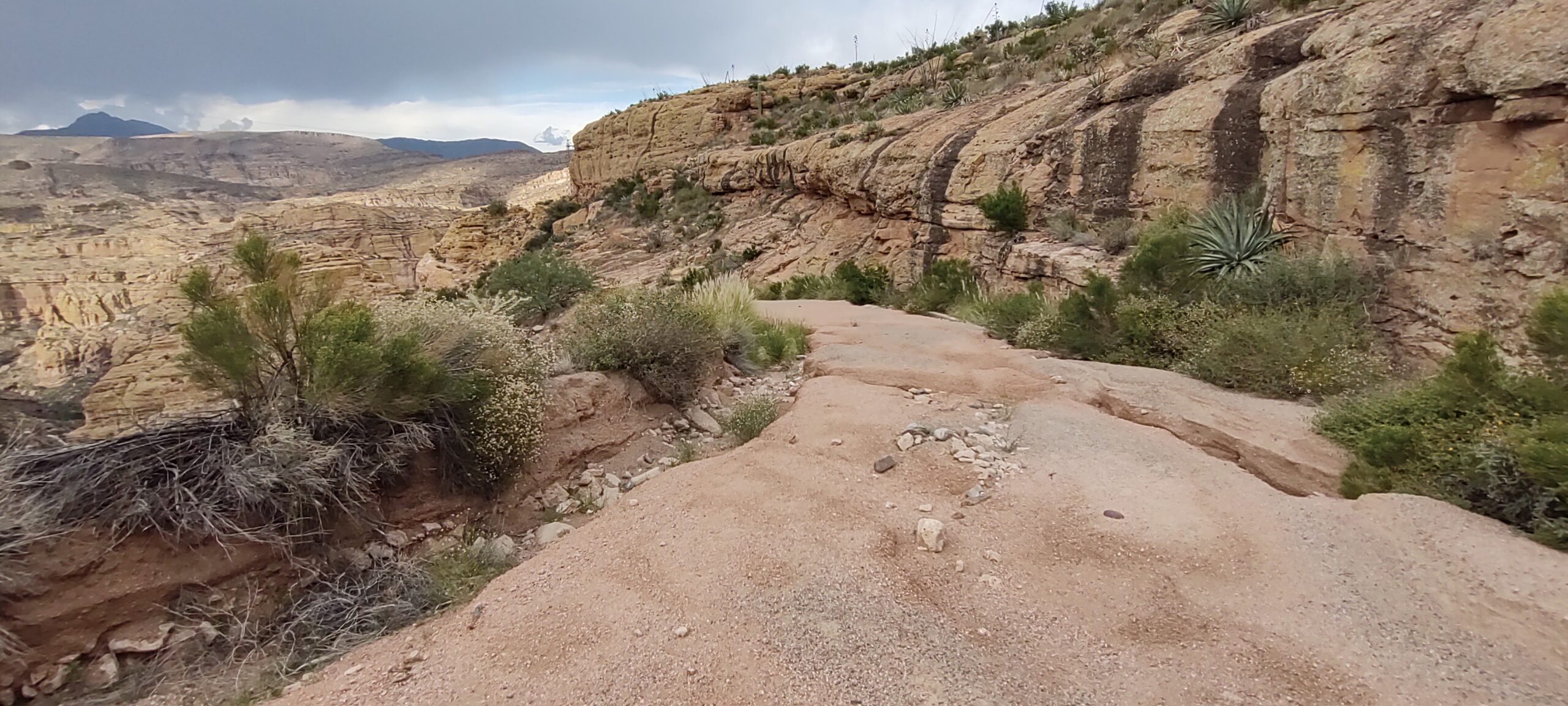
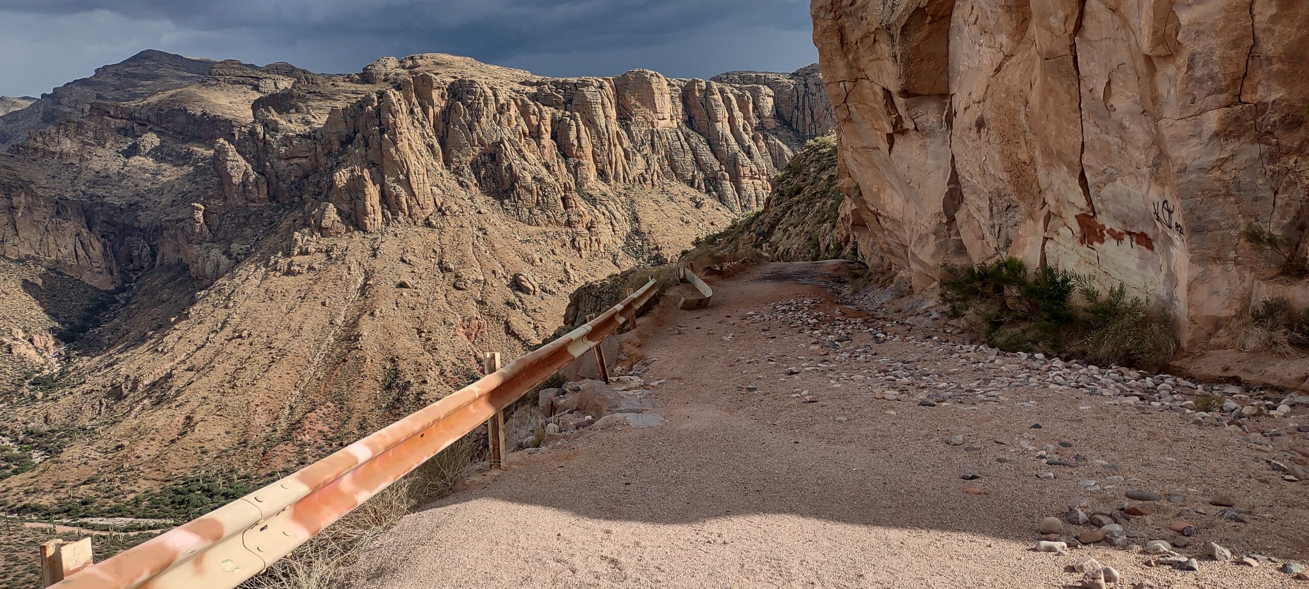
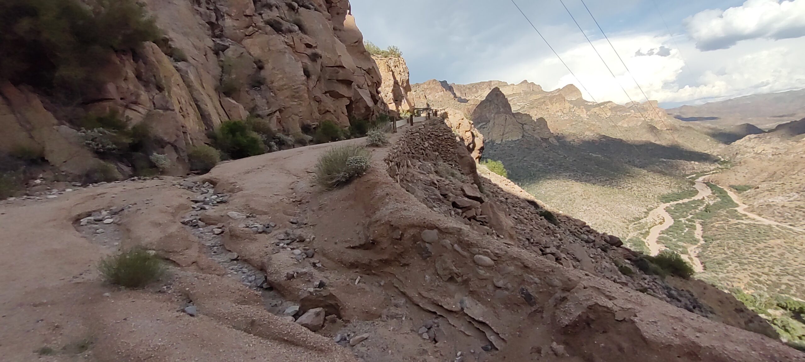
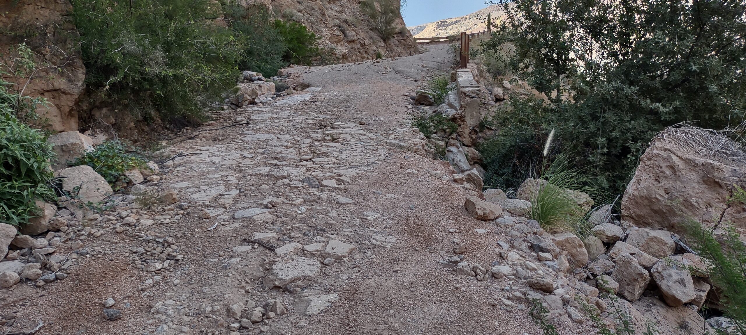
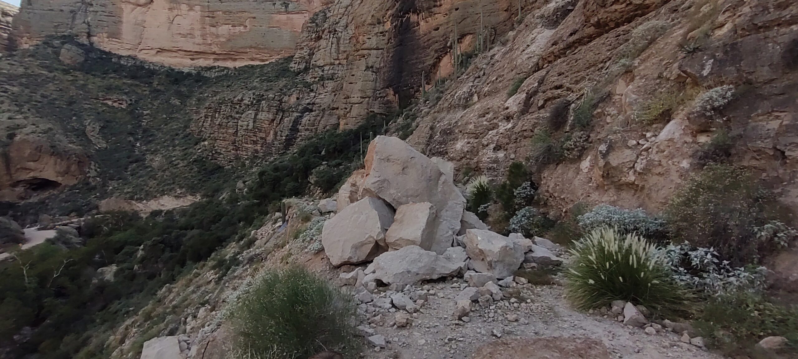
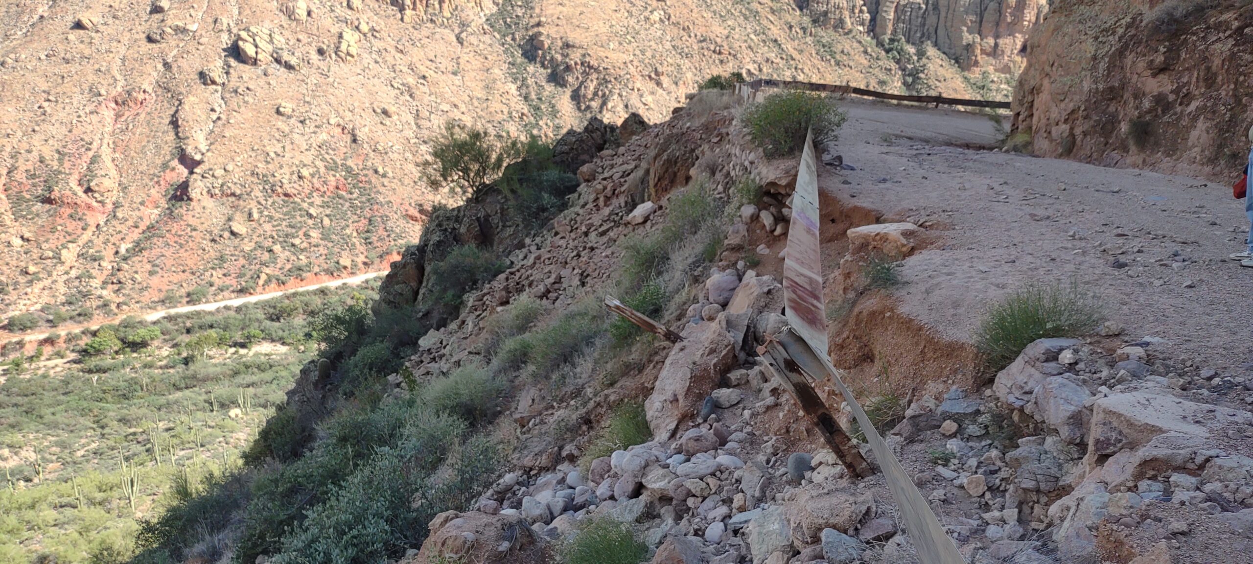
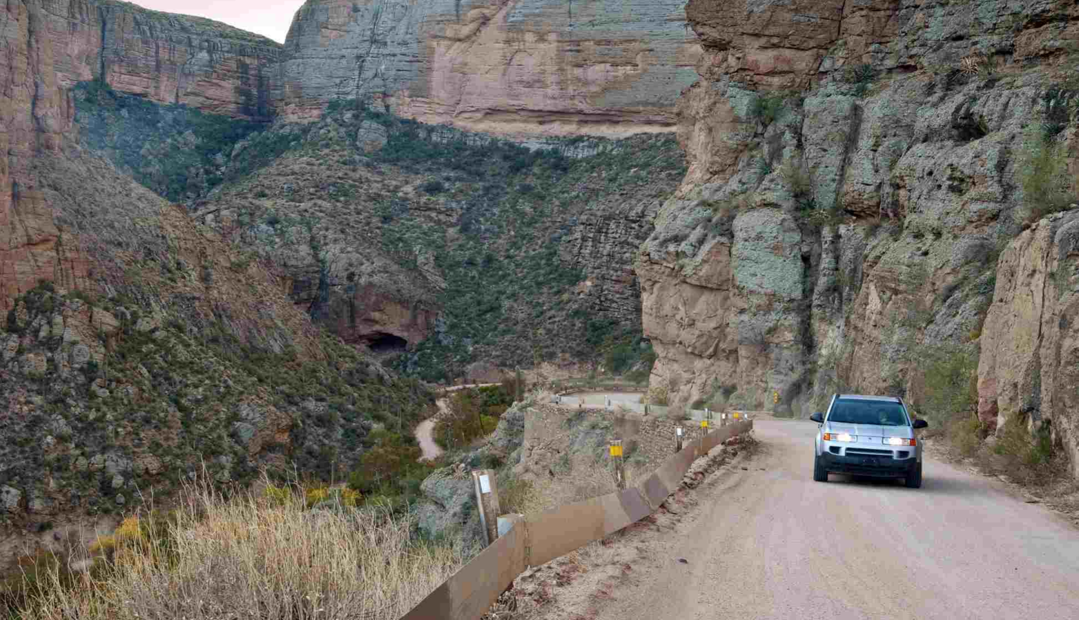
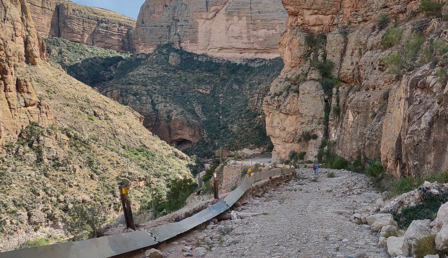
The Apache Trail has been closed for the past two and a half years because of a rockfall on the most scenic section of the Apache Trail. Fish Creek Hill is known for its white-knuckle descent and scenic overlook where the road straddles the cliffside to the bottom of Fish Creek (pictured above). The rockfall was caused by the remains of tropical storm Lorana that dumped over six inches of rain in a day. The storm came days after fire crews extinguished the Woodbury Wildfire, prompting concerns over soil stabilization and continued flooding. The Arizona Department of Transportation then closed the road indefinitely without a real explanation.
The Wildfire ripped through the Superstition Wilderness and was devastating to many recreation users. However, the fire never burned Fish Creek Hill or the streams that flow over the cliff. The chared landscape quickly recovered, sprouting green life just days after fire crews extinguished the fire. ADOT nor the Forest Service have seeded the area or attempted to rejuvenate the soil.
The Woodbury Wildfire damaged Apache Trail between the bottom of Fish Creek Hill to the Roosevelt Dam and was used as a firebreak to stop the Woodbury Wildfire from spreading north.
Days after fire crews extinguished the blaze, the Tonto National Forest Burn Area Emergency Response Team determined it would take three to five years before the soil would recover. Therefore, ADOT decided to put the Apache Trail on the backburner claiming that the road is a low-volume Road and thus not worth fixing.
Several years prior to the Woodbury Fire, planning for an improvement project by Central Federal Lands in cooperation with Tonto National Forest, ADOT, and local business owners began on the East Side of the Apache Trail. This project applies to a 14-mile section between Apache Lake Marina and Roosevelt Dam. This improvement is supposed to start this year and includes increasing the line of sight around corners, paving the road, and upgrading bridges and culverts. However, this improvement project does not include Fish Creek Hill, where giant boulders block the road.
Trying to forfiet the Apache Trail
For the past several years, the Arizona Department of Transportation has been trying to discard the Apache Trail. Whatever the reason, they don’t want it in the State Route System. However, the road was quitclaimed to Arizona in the 1950s by an act of the US Congress. There is a deed in the Maricopa County Recorders office.
Because the Apache Trail is a Revised Statute 2477 road, it is a fundamental right of passage that ADOT can not close without following strict procedures. Similarly, forfeiture of the road would likely require an act of Congress. Fortunately for us, Arizona law limits ADOT’s authority while making these decisions.
In 2017, the Arizona Department of Transportation conducted a Low Volume State Route Study that included the Apache Trail. The study also included 21 other state highways considered insignificant to ADOT. Those roads include Arizona’s most scenic highways like The Desert to Tall Pines, Coronado Trail, Swift Trail, and others. In this study, ADOT suggests these roads are low volume and gives several options for future maintenance of each state highway. Among the suggestions is the forfeiture of each road to other jurisdictions.
The Arizona legislature approved $700,000 to start the studies necessary to fix the Apache Trail, but ADOT has done nothing. The law approved funding for ADOT and compelled them to act. It appears ADOT thought the Wildfire would speak for itself, and it did. We gave ADOT the benefit of the doubt, and after two years, we believe it’s time to engage.
Arizona Backcountry Explorers has revived interest in this issue and has provided context to ADOT’s actions. We have given the public a way to directly contact the Arizona Highway Commission, Arizona Department of Transportation, and the Arizona Governor with a realistic request. These actions have resulted in County Supervisors hosting monthly meetings with the inclusion of several state and county political leaders, the US Forest Service, historical societies, business owners, state agencies, and members of the public working in tandem towards a shared goal. We have been on point the entire time.
The Arizona Department of Transportation hasn’t done anything but defend its narrative, and members of the Arizona Legislature are not thrilled with their actions (or lack thereof). All signs point to the need for the public to take action to prevent ADOT from permanently closing the Apache Trail. Since the day the rocks fell, business owners and Apache Trail users have been pressuring ADOT to open the road with very little success. There is currently a Change.org petition with over 30,000 signatures, but ADOT still won’t budge.
Since we have engaged, ADOT has received thousands of correspondences with concerned individuals and has vowed to keep us updated via social media and email. They have produced multiple pieces of content to explain what’s happening. However, much of what they are saying is not entirely true.
Senator Kelly Townsend is introducing a bill very soon to further compel ADOT to act. We are hopeful that this new law will protect the Apache Trail for generations to come. Additionally, we hope to force ADOT to withdraw the 2017 Low Volume State Route Study from further policy decisions. We believe that ADOT should never put our historical highways on the backburner simply because they are low volume. We also hope to create maintenance standards for dirt roads within the State Highway System.
Please help us reopen the Apache Trail
It’s because of you voicing your concern in our email petition that has brought this issue to the frontlines. Every time a person signs our petition, an email is sent to the entire Highway Commission, the Senior Division Administrator of ADOT, and Governor Doug Ducey. For the past three months, we have flooded their inboxes with over 1,700 emails from individuals as far away as Spain.