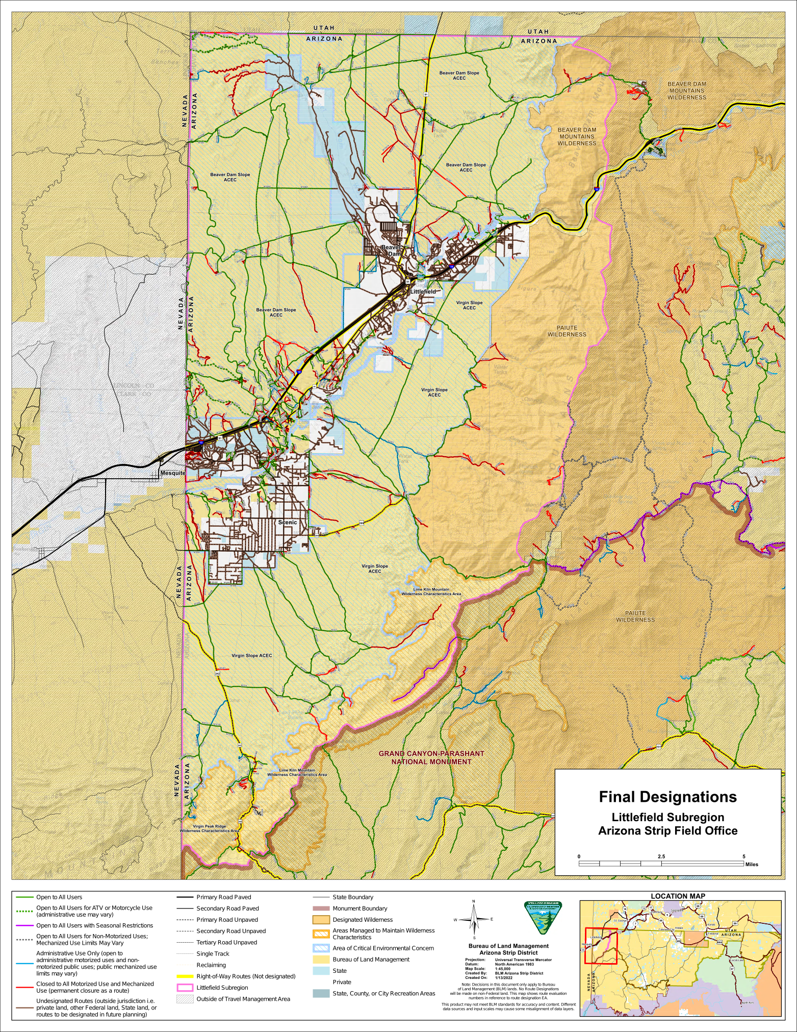
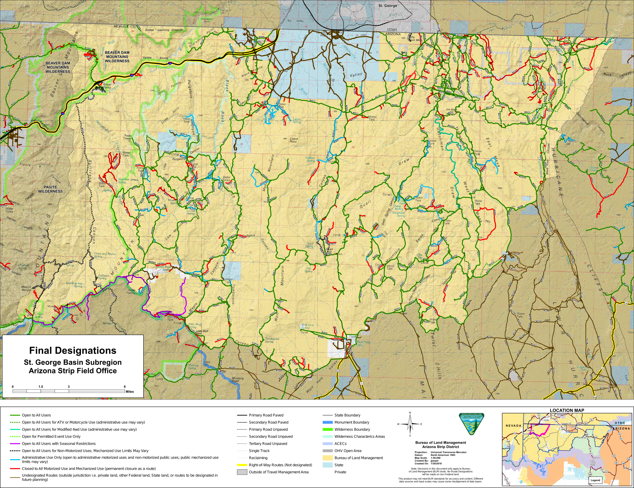
The Bureau of Land Management quietly released a final decision on a portion of a proposed transportation network in St George Basin, Colorado City, and Littlefield Arizona on March 9th, 2022. This proposal consists of two areas in the vicinity of Littlefield Arizona, and a separate area in the St George Basin and Colorado City area.
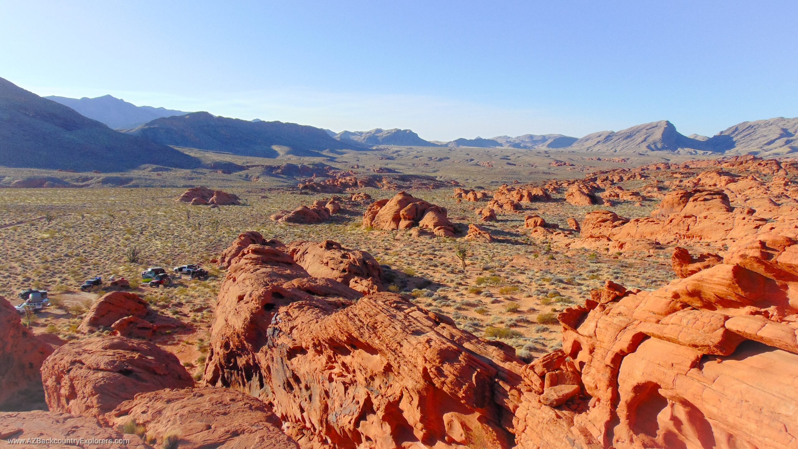
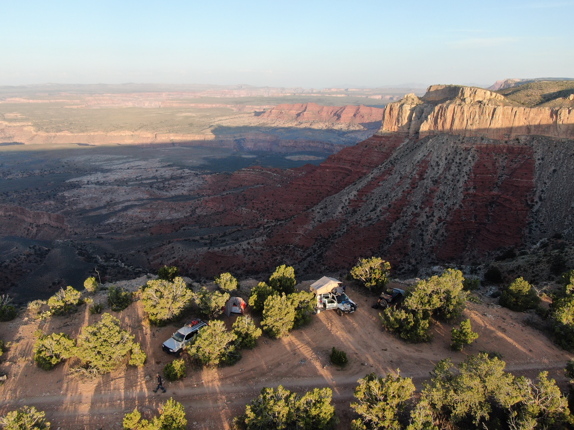
These areas are among the most prized adventure destinations in all of Arizona with some very popular destinations. At the same time, 90% of the area is the least visited public land in the state, dominated by massive sandstone formations and the deepest canyons in Arizona that are only accessible by 4×4 vehicles. 90% of the area is an isolated wasteland, with the occasional sighting of a lone rancher.
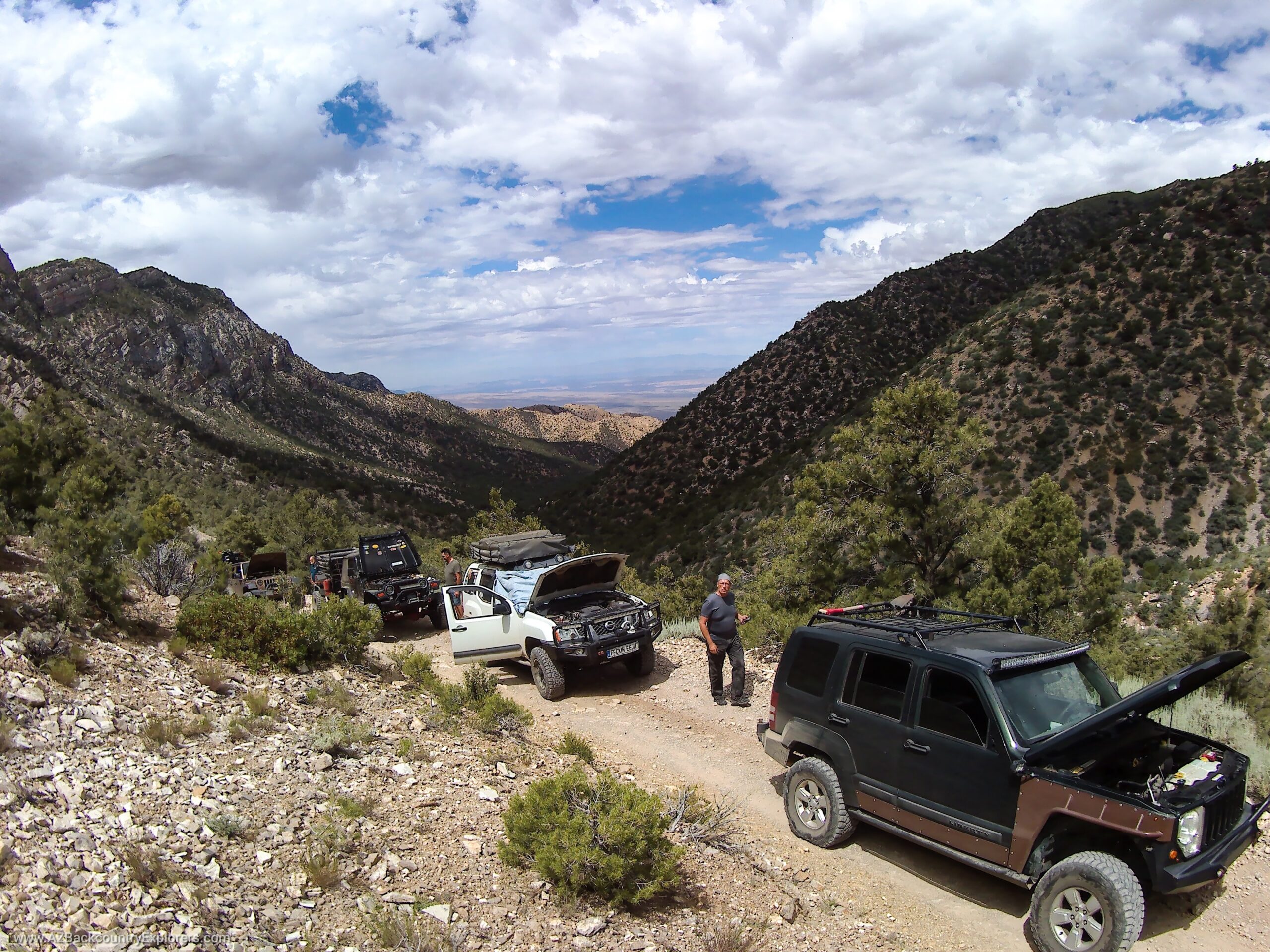
Most of the roads in the area dead-end at canyon overlooks at multiple points between the Grand Canyon and the Utah Border. These areas provide public access to multiple recreation opportunities that are dispersed throughout the area including dispersed and primitive camping.
The final decision released in March applies to the Littlefield, Arizona portion of the plan. The final decision on the St. George Basin and Colorado City portion was approved in 2018.
Out of a combined 1,544 miles of roads in the project areas, only 903 miles will remain open with a total of 641 miles closed to motor vehicles or limited for other uses. Out of the 641 miles, 316 miles will be permanently closed to all uses.
These closed roads are primarily short side roads that lead to dispersed camping sites or river access areas along the Virgin River. Likewise, several sections of road that connect entire trail systems, are closing.
Littlefield, Arizona | 50% of Roads Closed
206 miles of roads will be closed around Littlefield and Mesquite Arizona with only 218 miles remaining open. Out of the 206 miles of roads closed, 140 miles will be closed to mechanical use, and the remaining designated for other uses.
Most of the closed roads in this plan are river access areas and campsites along the Virgin River outside of the towns of Mesquite and Littlefield. These river access areas can be found on USGS topo maps as early as 1954 and cannot be closed per Revised Statute 2477 and Arizona Revised Statute 37.931.
Likewise, multiple roads are closing within the Paiute Wilderness which brings into question the legitimacy of the wilderness designation. This plan shows that the towns of Mesquite and Littlefield are surrounded by designated Areas of Environmental Concern that introduce further restrictions in the future.
This decision will restrict use during certain times of the year on several roads in the region. Access will be limited to seasonal use on Elbow Canyon which provides access to the Parashant National Monument from the west. This road is a nice drive suitable for any 4×4 vehicle.
St. George Basin and Colorado City
The final decision for the St. George Basin and the Colorado City sub-region was released in 2018. The area consists of 1,117 miles of roads. In 2018, the Arizona Strip Field Office released its final decision to close 466 miles, leaving only 651 miles open to the public.
A majority of these roads are short side roads that lead to primitive dispersed campsites and beautiful lookouts. There are also several roads closing that travel through canyons, cross rivers, and provide access to historical places.
A big loss recreation
This final decision will impact all public land users by closing long-established roads that provide access to dispersed recreation opportunities. A majority of these roads are valid and established rights of way that were granted by the U.S. Congress in 1865. These public rights of way are under the authority of state law and have existed for more than 130 years.
In the plan, the federal government notates its authority under the Federal Land Policy Management Act (FLPMA). However, in three separate sections, the Federal Land Policy and Management Act specifically recognize that all valid existing land use rights are not affected by FLPMA. In other words, The Federal Land Policy Management Act does not apply to any right of way, water right, grazing right, or any other land use right that existed at the time of its passage in October of 1976.
A right of way inherently provides a fundamental human right to have free movement across the land of the United States. The very idea of a right of way is to provide a passage where the public can freely travel across land owned by another. It is a servitude imposed by common law on the underlying landowner and recognizes the free movement of people across the surface of the earth.
It is a well-known fact that the federal government has no authority over these roads and we must stand against any further regulation. Early federal regulations and the supreme court have always applied state law when dealing with rights-of-way because the federal government has limited legislative jurisdiction over public lands in the Western U.S. per the U.S. Constitution.
How To Take Action
We suggest you contact your political representatives in the state Legislative District 5, Mohave County, and Congressmen Gosar ASAP and ask them to oppose this proposal and force an immediate withdrawal.
Mohave County Board of Supervisors
Mohave County is known to protect our right to way across public lands. They are our most valuable resource. Please contact the Mohave County Clerk of the Board ASAP.
Congressman Paul Gosar
Congressmen Gosar is also known to protect our right to access public lands. Please contact his Prescott office below.
State Legislature
You can email the Arizona legislature in District 5 using the form below. Please be respectful and ask them to oppose this decision.