

The Bureau of Land Management has released the second decision on the Black Canyon Corridor Travel Management Plan after a group of dedicated advocates forced a complete withdrawal in October of last year. Our group consisted of Arizona Backcountry Explorers, Blueribbon Coalition, American Mining Rights Association, Arizona State Association of FWD Clubs, and the Arizona Undertakers.
The proposed plan originally identified 499 miles of roads with 288 miles either limited by vehicle type, non-motorized or closed. We were able to point out multiple inconsistencies and errors in the proposed plan that limited access to active mining claims and state land. Likewise, we were able to identify inconsistencies between trail designations in the proposed plan, and road designations on US Forest land. Thereon, the Bureau Of Land Management decided to withdraw the proposed plan just prior to our appeal.
The new proposal
The Bureau of Land Management contacted our group of concerned advocates and assembled a virtual meeting to hear our concerns. Approximately 20 Bureau employees attended the meeting with representatives and members of Blueribbon Coalition, Arizona Road Runners Prospecters Club, Arizona Undertakers 4×4 Club, and Arizona Backcountry Explorers. Several people raised concerns over access to active mining claims, NEPA compliance, and multiple other issues. Our comments were, and remain, focused on the Revised statute 2477 roads and the lack of legislative jurisdiction.
During the meeting, it was revealed that the entire Hassayampa Field Office is new and the meeting was a chance to hear our concerns. “This meeting… is not a NEPA tool,” said Chelsey McKinney from the Hassayampa Field Office. “This is an opportunity for us, new staff here in HFO, to meet with public recreation, mineral, public land users about their concerns. It’s more of a listening session.”
The Travel Management Plan was conducted in partnership with a California-based consultant agency Advanced Resource Solutions Inc. On its website, ARS claims to specialize in travel management planning, mitigation, and environmental compliance. Their notable projects include route evaluation and designation in Kingman, Lake Havasu, Phoenix, Safford, Arizona Strip, Tucson, and Yuma Field Offices. Since 2003, Advanced Resource Solutions has been awarded 124 contracts for a total of 23.4 million dollars to conduct travel management planning in Arizona, Utah, California, Nevada, Colorado, and Montana.
Major Concern
Reduction in total roads.
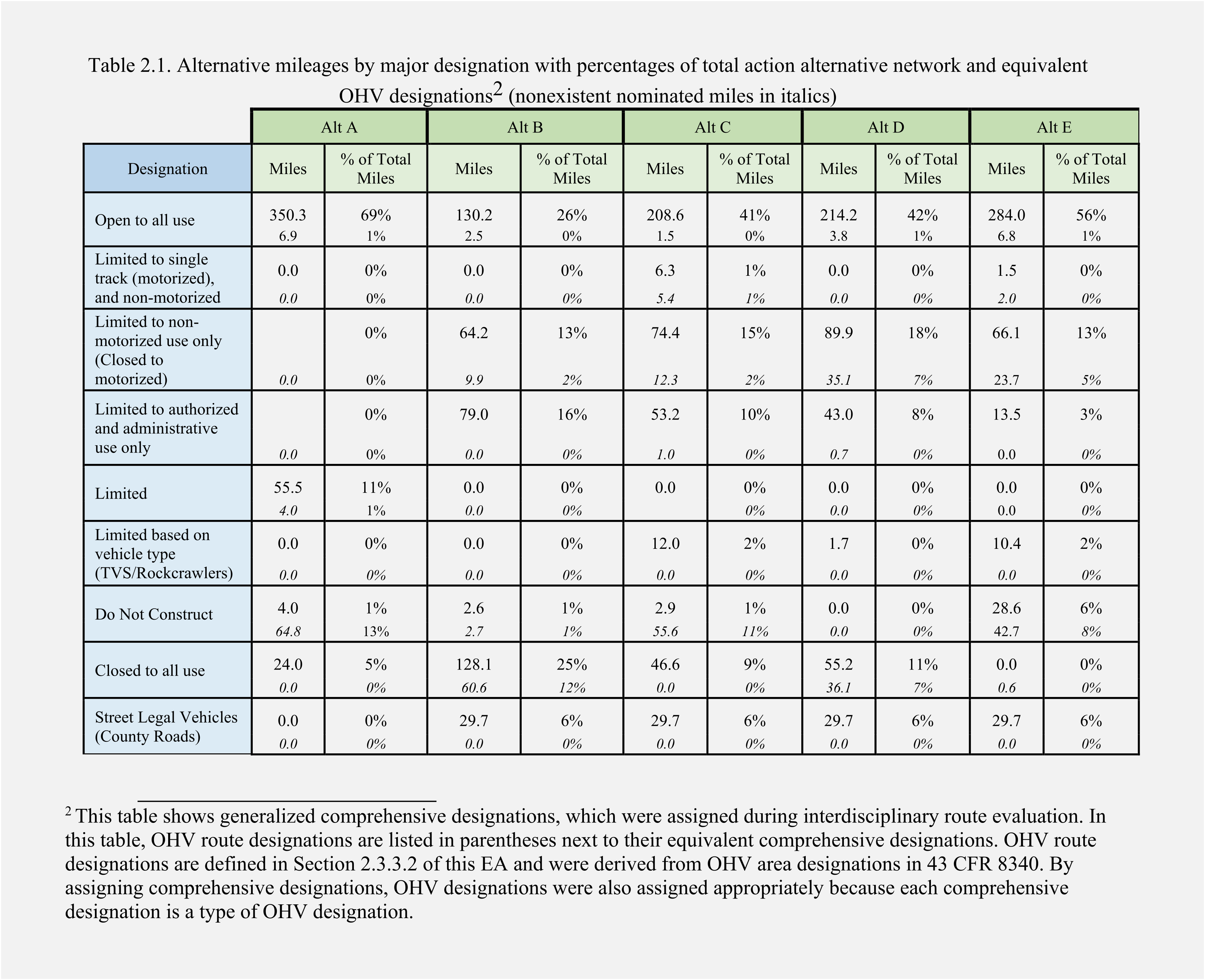
There are some significant inconsistencies in alternative C where the total mileage of roads does not add up to alternative A. Alternative A is used as a baseline and represents the total mileage of roads the BLM has in their system within the project area.
This new plan has reduced the mileage of roads in the travel network to a total of 440.7 miles while an estimated 54% of roads are closed, restricted, or limited. The previous plan included 499 miles of trails in the entire travel network with 57% closed. This included motorized and non-motorized roads and trails that were designated as open or closed. It’s still unclear where this discrepancy comes in.
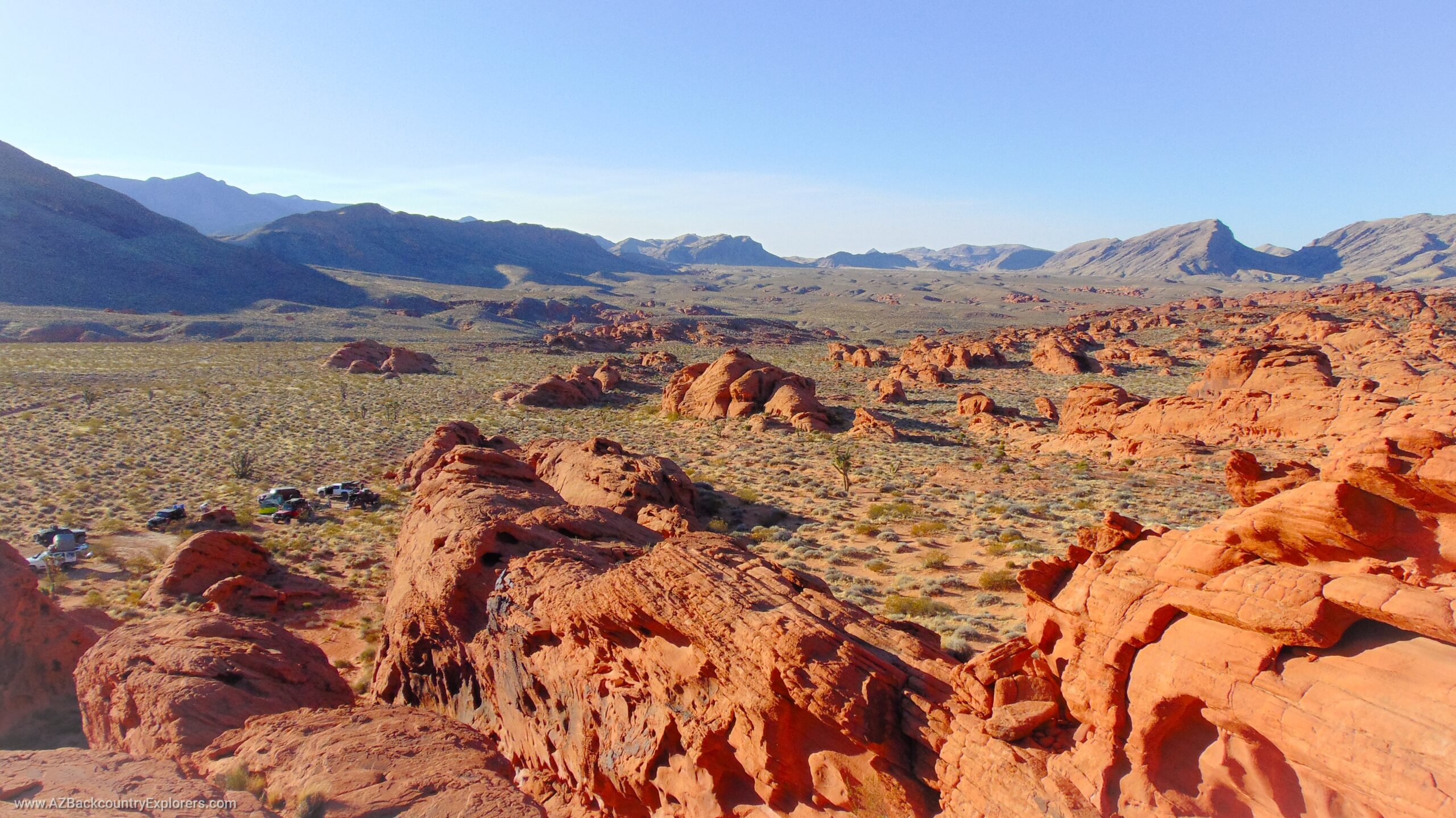
Black Canyon National Recreation Trail
Small slivers of BLM land create a buffer zone around the Black Canyon trail as it traverses Arizona State Trust Land. From North to South, approximately fifty-seven roads that cross the trail will be closing. In many cases, these are small sections of existing roads that intersect the buffer zone around the Black Canyon Recreation trail. In other cases, sections of the National Recreation Trail itself is a motorized road.
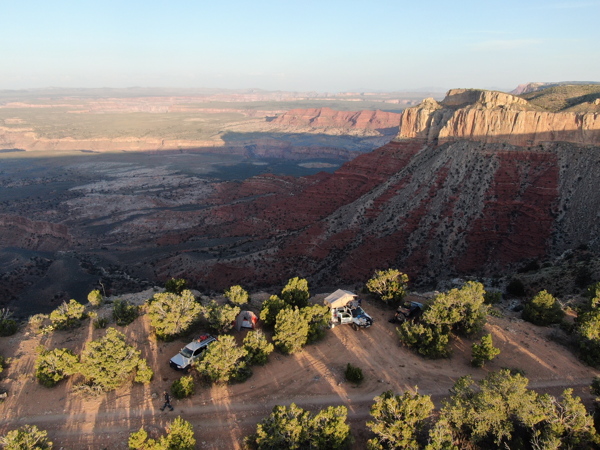
Dispersed Camping
Multiple dispersed campsites are being closed. Many of these trails are short side trails or roadside pull-offs that are accessible to RV and passenger cars. Others are short side roads that lead to mountain tops, old cabins, or old mines which are marked on the Mineral Resource Data System, indicating the application of RS 2477.
Revised Statute 2477 rights of way
Although the Bureau did address the concerns of the county, there are multiple RS 2477 rights of way labeled as closed in the preferred alternative C. As mentioned above, there are multiple roads leading to known mineral deposits in the project area. Many of these localities are marked in Mineral Resource Data System. These listings, along with official survey plats, provide an opportunity to determine RS 2477 applicability.
The following existing roads either fall under the scope of RS 2477 rights of way or are valid RS 2477 rights of way that are closing in the new plan. BC1188, BC1299, BC1291, BC1296, BC1306, BC1188, BC1256, BC1165, BC1257, BC1268, BC1259, BC1198, BC1161, BC1167, BC1108, BC1160, BC1157, BC1125, BC1113, BC1117, BC1131, BC1122, BC1131, BC1107, BC1109, BC1251, BC1123, BC1182, BC1111, BC1194, BC1300, BC1299, BC1300, BC1342, BC1320, BC1321, BC1322, BC1278, BC1068, BC1701, BC1072, BC1077, BC1209, BC1246, BC1213, BC1215, BC1217, BC1220, BC1222, BC1036, BC1034, BC1032, BC1235, BC1083, BC1202, BC1208, BC1207, BC1090, BC1092, BC1088, BC1047, BC1062, BC1065, BC1056, BC1053, BC1100, BC1101, BC1144, BC1145, BC1137, BC1134, BC1137, BC1141, BC1140, BC1138, BC1106, BC1103, BC1112, BC1159, BC1129, BC1166, BC1197, BC1346, and BC1274.
Major Victories
Although the above concerns render this plan unacceptable, we feel it’s important to give recognition to the Bureau for addressing some of the Revised Statute 2477 concerns of motorized users, the Yavapai County Board of Supervisors, and Arizona Backcountry Explorers.
Furthermore, under alternative C, the Bureau has included 16 out of 18 world-class rock crawling trails that were introduced by the Arizona Undertakers 4×4 Club for a total of 12 miles. In addition, the Bureau has nominated 19.9 miles of new roads and trails for construction. This includes 1.5 miles open to all use, 12.3 miles limited to non-motorized use, 5.4 miles of single-track motorized trails, and 1 mile for administrative use.
Black Canyon Corridor Travel Management Plan Map
You can review the proposed action by the Bureau of Land Management using the map below or visit the project website to read the documents.
Please Take Action
The proposed plan is open for comment until August 20th, 2022. You can add your voice to ours by submitting your comments using the form below. Please submit your comments even after the deadline, as we will continue to work on this plan
Your comments will be submitted to the Arizona Bureau of Land Management Hassayampa field office, the Yavapai County Board of supervisors, and State Legislative Representatives.
Comment on the Black Canyon Corridor Travel Management Plan
Arizona Adventure Alliance
Arizona Backcountry Explorers continues to play a significant role in the development of these proposed restrictions to assure we have access to these lands in the future. The team, known as the Arizona Adventure Alliance, consists of national and local entities representing public land users in the small-scale mining and motorized use community including Arizona Backcountry Explorers, The Blueribbon Coalition, the American Mining Rights Association, and the Arizona Association of 4WD Clubs. Together, we are working to assure this plan allows a balanced use regimen while each defending our organizational goals.
Our friends at Blueribbon Coalition are preparing for a legal battle with the black Canyon Coridore Travel Managament Plan. We are offering a joint membership that will include a one year membership to the Blueribbon Coalition, American Mining Rights Association, Arizona Association of 4WD Clubs, and Arizona Backcountry Explorers. Your contribution will help all four groups continue the fight to defend every inch of motorized road.