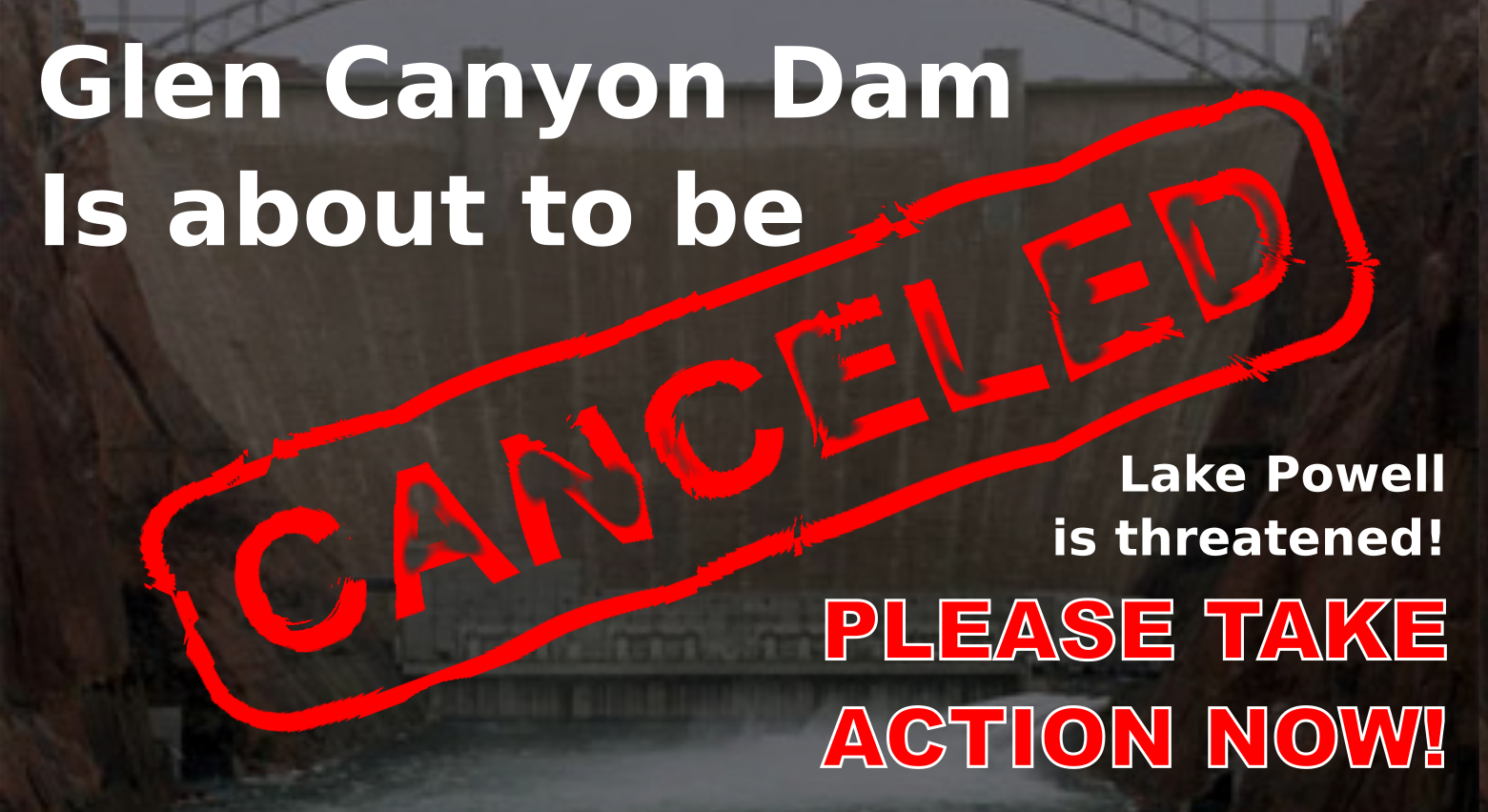


A new proposal is put forth by the Glen Canyon Institute, Utah Rivers Council, and the Great Basin Water Network, calling for diversion tunnels around Glen Canyon Dam to keep water flowing in the Colorado River. They claim that if action is not taken, the Colorado River will seize to flow and trigger a firestorm of curtailment.
The Glen Canyon Dam has a total of ten outlets. Eight outlets lead to penstocks that turn hydroelectric generators and require a minimum water elevation of 3490 feet above sea level to generate electricity. There are two additional river outlets at 3,370 feet that can release a maximum of 15,000 cubic feet per second. When water levels are between 3,490 feet and 3,370 feet is where problems arise, according to the group of environmentalists.
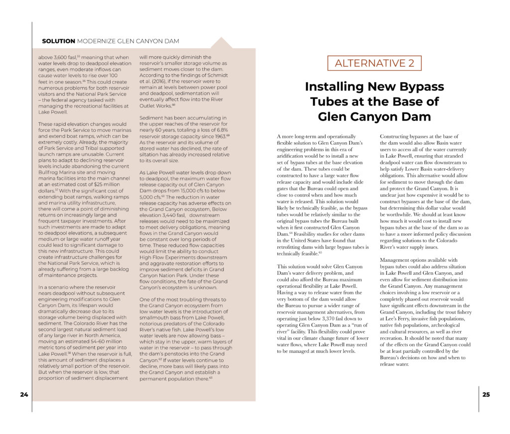
According to the 36-page report, the limited flow of the two river outlets is insufficient for the Colorado River Upper Basin states to meet the obligations of the Colorado River Compact Agreement. Additionally, they argue that the Colorado River could run dry if Lake Powell drops below the river outlets at 3,370 feet; at which point they claim, drastic alterations to Glen Canyon Dam will need to be made. As a solution, they provide two alternatives to “Modernize Glen Canyon Dam” that include retrofitting the river outlet works to release more water and Installing new bypass tubes at the base of Glen Canyon Dam.
A bigger agenda
The Glen Canyon Institute is one of several organizations that have been advocating for the removal of the Glen Canyon dam for decades and is known to be affiliated with the Southern Utah Wilderness Alliance. They have developed what they call the “Fill Mead First” proposal that suggests prioritizing Lake Mead levels over Lake Powell to sustain a free-flowing river through the Grand Canyon. They recently updated their website to include detailed information on how to achieve their agenda.
The Fill Mead First Proposal lays out a three-phase process to remove Glen Canyon Dam and restore the river to its natural state. The Fill Mead First proposal is an extension of the 1999 Glen Canyon Institute’s Citizens Environmental Assessment on Decommissioning of Glen Canyon Dam. On their website, the Glen Canyon Institute writes the following describing the Fill Mead First proposal.
“The idea behind the Fill Mead First proposal is to move water stored in Lake Powell downstream to Lake Mead. Currently, there is not enough water between both reservoirs to keep even one full. This process would take place through three stages, ultimately leading to the restoration of a free-flowing Colorado River through Glen Canyon and Grand Canyon.
The first stage is where Lake Powell would near 3,490 feet, or minimum power pool. At this stage, there would still be little to no power generation at the dam and some reservoir recreation. At 70 feet below the level of Lake Powell as of spring 2021, this stage of Fill Mead First would allow much of Glen Canyon’s world-renowned landscape to reemerge and be restored.
In the second stage of Fill Mead First, the reservoir’s level would near 3,374 feet, near the river outlet works. At this stage a significant amount of Glen Canyon would be exposed, allowing remarkable opportunities for restoration. No power would be generated at this stage, and much less water would be able to move through the dam because of reduced outlet capacity.
The third stage of the Fill Mead First would entail drilling new diversion tunnels around Glen Canyon Dam, and allowing the Colorado River to flow freely through it. This would allow for optimum restoration of Glen Canyon, and for normalized sediment flows to take place in the Grand Canyon, which has been starved of sediment for the last 50 years. Hydropower generation turbines could be installed in the tunnels to produce electricity.”
Glen Canyon Institute Fill Mead First proposal
On their website, Glen Canyon Institute equates the Citizen Environmental Assessment to actions taken by Glen Canyon Environmental Studies in 1980 that led to a complete reform of how the Glen Canyon Dam operates and ushered in interim guidelines that were established by the BOR in 1991. The group was able to set the basis for an environmental impact study of the operation of Glen Canyon Dam that changed water flow rates from a regimen that was based on hydroelectric power demand, to pulse water release patterns that allegedly promote environmental goals. In 1997, the final operating criteria were signed by the Secretary and the operation of Glen Canyon remained under the same guidelines until 2016.
The Bureau of Reclamation is mandated by section 1804(b) of The Grand Canyon Protection Act of 1992 to submit a yearly report to congress, and each governor of the basin states, detailing the operations of Glen Canyon Dam. The Law also required the General Accounting Office to audit the Environmental Impact Statement on the Operation of Glen Canyon Dam.
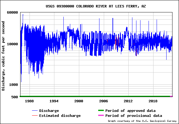
In October of 2016, the operation guidelines were again reformed during the Long Term Experimental and Management Plan for the Operations of Glen Canyon Dam by the Bureau of Reclamation. This plan gave the BOR discretion to conduct High-Flow Experiments (HFE) that release up to 45,000 cubic feet per second for up to 250 hours at a time. According to the Bureau of Reclamation High Flow Experiment Protocol, a high flow experiment is triggered by sediment buildup from the Little Colorado River and can be conducted by simply notifying a group of stakeholders. Stakeholders such as the Glen Canyon institute.
The Bureau of Reclamation turned down the Fill Mead First and a Run Of The River proposal that incorporates hydroelectric generation without water storage, stating the following in the Final Environmental Impact Statement.
“The alternative would not allow compliance with water release requirements, including, but not limited to, the division and apportionment of the use of the waters of the Colorado River system under the Colorado River Compact, as well as other portions of the Law of the River and 2007 Interim Guidelines (Reclamation 2007a,b). In addition, the alternative would not comply with other federal requirements and regulations, including the GCPA (Grand Canyon Protection Act).”
Final Environmental Impact Statement of the Long Term Experimental and Management Plan for the Opperation of Glen Canyon Dam. – Bureau of Reclamation
The Glen Canyon Institute proclaims the Citizen Environmental Assessment will be implemented through guidelines by the Council on Environmental Quality and the National Environmental Policy Act. According to Glen Canyon Institute, It will evaluate the restoration of Glen Canyon, restoring and protecting the long-term ecological sustainability of Glen Canyon, and safety of Glen Canyon Dam, and the variability of water supply and floods in the Colorado River.
Water Crisis Considered Restoration
While the media is trying to scare the daylights out of people, the Glen Canyon Institute refers to the water shortage on the Colorado River as “restoration” and appears to be establishing the foundation to support the removal of Glen Canyon Dam. Researchers are currently in a frenzy to document the reemergence of archeological sites, endangered species, plant life, and the other changes happening while the reservoir is relieved of its duties.
According to the Outreach Director of Glen Canyon Institute, sediment is moving to the bottom of Glen Canyon “as a result of inaction on a quick drawdown” and slowly clogging up the river. Environmentalists have long argued that the Colorado River has been starved of natural sediment that once created beaches along the Colorado River. They claim that since Glen Canyon Dam was constructed, the Colorado River through the Grand Canyon has suffered erosion, loss of beaches, loss of riparian and wetland habitat, and impacted fish populations. This, they say, must be remedied by restoring the Colorado River through Glen Canyon to allow sediment to move downstream.
Bureau of Reclamation requesting input
The Bureau of Reclamation is seeking public comments on operation strategies for Lake Powell and Lake Mead.
Like always, environmental groups are seizing the opportunity to thrust the Fill Mead First proposal into the mainstream to gain support from members of the public.
Please Take Action
Use the form below to submit your comments on the proposed action to the Bureau of Reclamation. Your comments will also be submitted to Congressional, state, and county political representatives to mobilize them to take action.
Post-2026 Colorado River Reservoir Operational Strategies for Lake Powell and Lake Mead
This petition is now closed.
End date: Mar 09, 2022
Signatures collected: 5