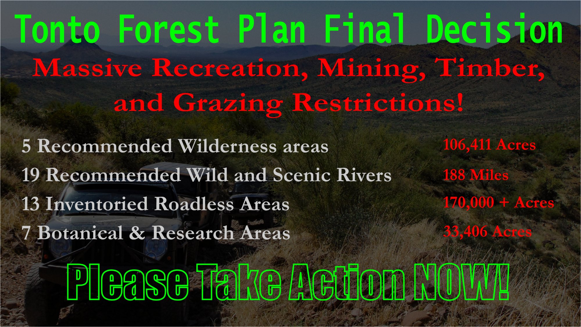
BlueRibbon Coalition/ShareTrails
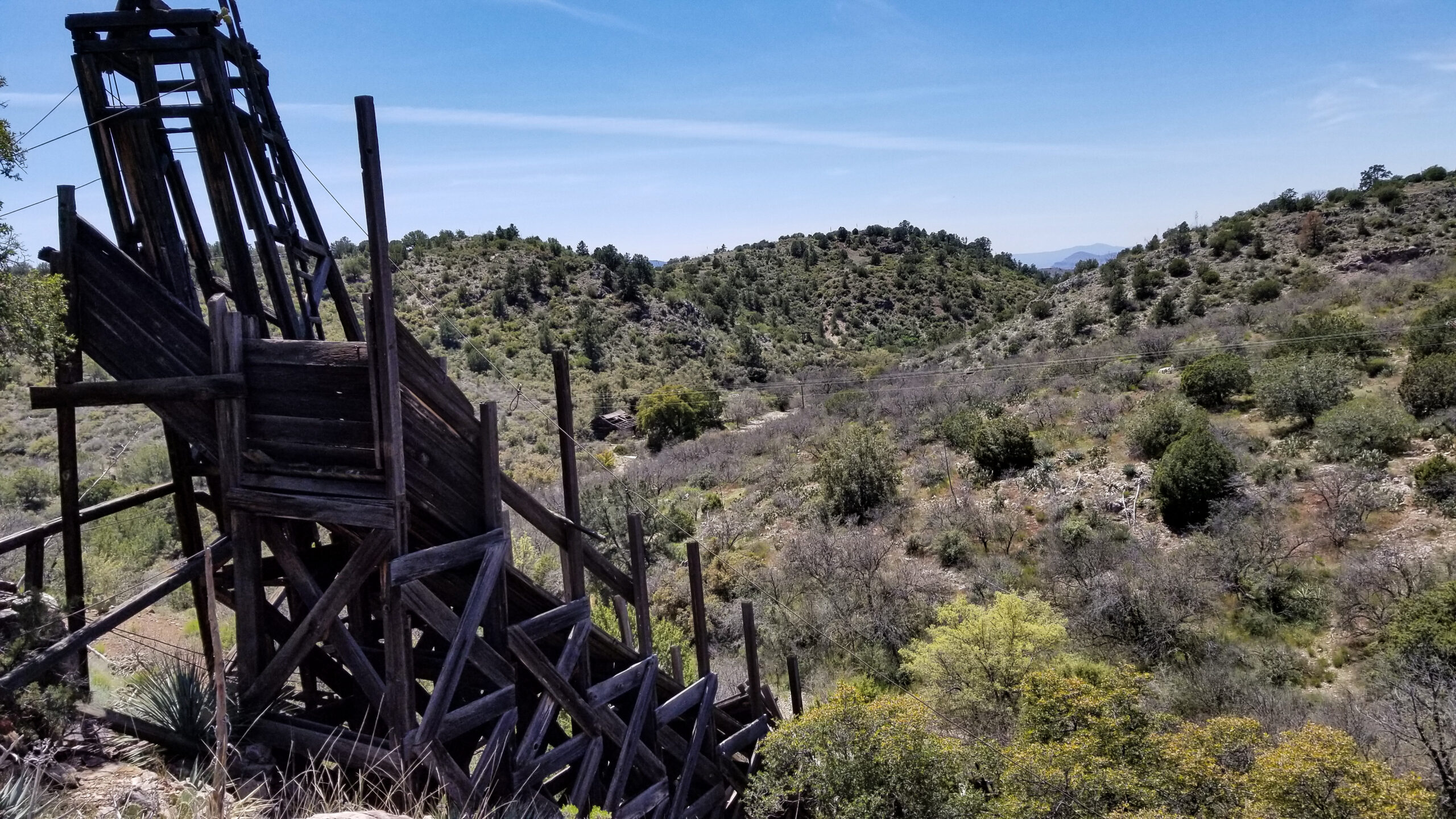
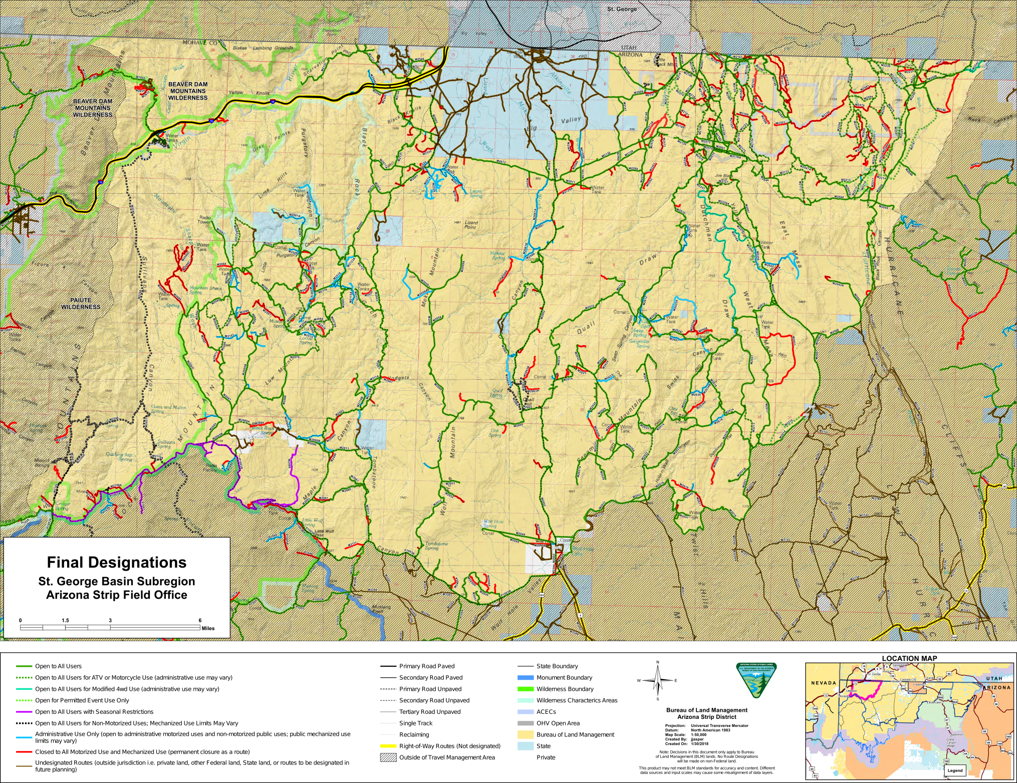
As part of the ongoing travel management process in Utah where access to over 10,000 miles of roads and trails are at stake, The BLM is currently requesting scoping comments for the Book Cliffs Area in Uintah County. This is some of Utah’s wildest country with herds of elk, deer, bison, and bighorn sheep drawing hunters from around the world to the area. It is also used by bear hunters and cougar hunters. It is also popular for shed collecting. Like many of Utah’s counties, Uintah County and the town of Vernal have started promoting the off-road recreation opportunities of the area, and organized groups are starting to discover this area that has been accessed by hunters for years. This area receives heavy use from the oil and gas industries. It is also an area with significant potential for free, open dispersed camping. The area also has a rich history of supporting grazing uses.
With almost 2,000 miles of routes being analyzed, this is an area with extraordinary amounts of access to cater to the numerous users who use this landscape. As part of the 10,000+ Project, BlueRibbon Coalition encourages all of its members to make a public comment to preserve access to this area.
The Deadline for Submitting Comments is July 23. Here is the link to the BLM planning page where you can make a comment: https://eplanning.blm.gov/eplanning-ui/project/79313/570
The best comments will provide unique feedback from those with experience in the area. If this is an area where you enjoy using public land, we encourage you to share you feedback with the BLM.
Users can also add their voice to give weight to several of the issues we will be raising our public comment. Here are some of the issues we will be highlighting:
This area receives heavy use from multiple user groups. BLM should keep open as many routes as possible to prevent overcrowding.Many of the routes that travel through side canyons and spurs and to scenic lookouts or pulloffs from main routes have high recreation value as dispersed camping sites. BLM should not be making decisions based on lands included included in pie-in-the-sky legislative proposals that have never been passed into law.BLM should not be closing county R.S. 2477 roads in this area. If R.S. 2477 routes are reclaiming, BLM should work with Uintah County to maintain the roads for public use.This area has high recreation value for hunting, off-road exploring, shed hunting, rock hounding, wildlife viewing, photography, and camping.Roads that travel through and into wilderness study areas should be kept open. Wilderness is supposed to be land that is untrammeled by man, so an area with that includes roads in it shouldn’t even qualify as a wilderness study area. Without the process called “cherry-stemming,” where the roads that cross wilderness designations aren’t counted as part of the contiguous land area, these areas wouldn’t even be eligible for wilderness consideration. Because these roads complicate the potential for wilderness designation, wilderness advocates will be pressuring BLM to close roads in this area. BLM should consider removing these lands from wilderness inventories before they consider closing any of the roads in these areas.
Also, the best comments will also identify specific routes, camping spots, and areas where you like to recreate. You can describe these briefly in your comment, or you can make route specific comments on the BLM’s interactive map:
https://eplanning.blm.gov/EPLCommentMap/?itemId=5df1b974bd494a1e85b6e7245077003a
This video demonstrates the process for making a comment about a specific route:
It’s not required to make route specific comments, but if you’re familiar with the area, and you have on-the-ground knowledge of this area, this is the point in the process where it is important for you to share your feedback.