

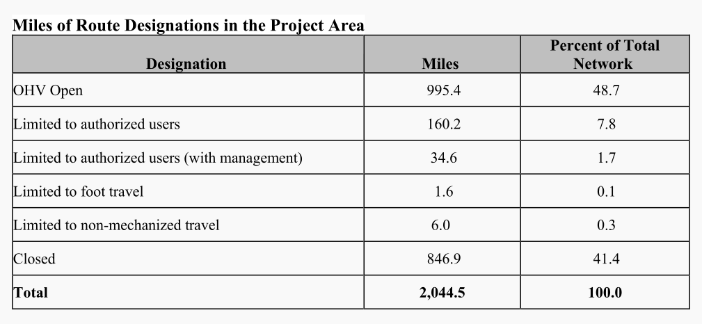
Bouse, Arizona – The Bureau of Land Management has quietly released another final decision on a Travel Management Plan previously withdrawn in 2018. The final decision has identified 2,044 miles of roads on a vast section of 783,819 acres of public lands. The project area stretches from I10 at the southern boundary, to just north of Parker, Arizona. The final decision will decommission or limit the use of 722 existing roads that total 1,049 miles, or 52% of existing roads. A total of 846 miles of roads will be permanently closed, and 162 miles will be kept for administrative use only.
Similar to the Arizona Strip Travel Management Plan that was released earlier this year, the final decision on this plan came out of nowhere and has been absent from the Bureau’s official NEPA register for 6 years. The final decision is nearly identical to the forced withdrawal in 2018 and contains hundreds of pages of documents to justify the Bureau’s overreach of power.
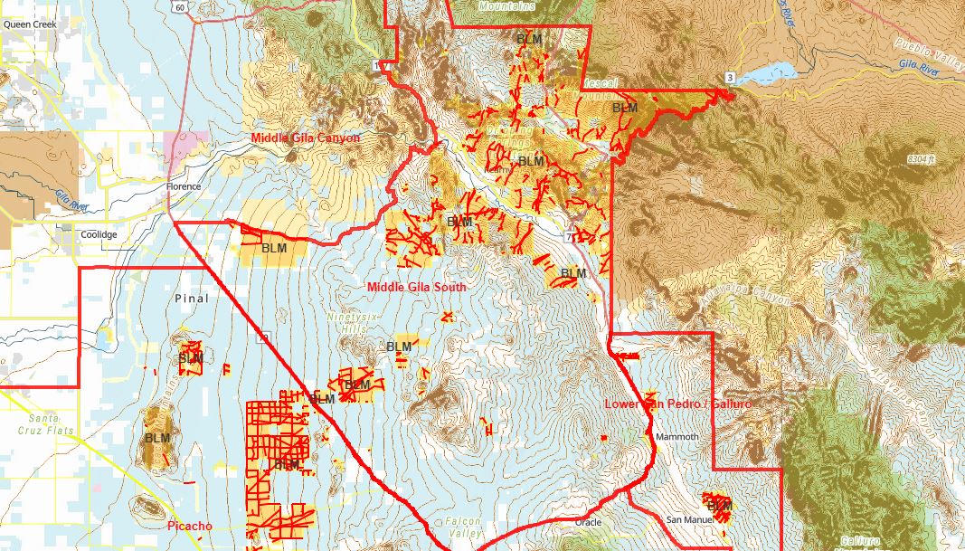
The Travel Management Plan consists of two travel management areas which contain thousands of campsites and roads that are visible on maps and survey plats as early as 1860. The Cactus Plain travel management area crosses state lines and consists of about 300 miles of roads on 84,000 acres of land located in California. Therefore, California state agencies are involved in the planning process. Moreover, a California-based research firm called Advanced Resource Solutions, which claims to specialize in travel management planning and federal environmental policy compliance, was awarded nearly $500,000 in federal contracts by the Arizona Bureau of Land Management to conduct the Biological Assessment, Socioeconomic analysis, and route evaluation.
As we have written about before, the Arizona and California State Historic Preservation Offices have entered into a Programmatic Agreement with the Bureau of Land Management concerning travel management planning and preserving historical sites under section 106 of the Historic Preservation Act. This agreement was developed in response to the withdrawal in 2018 and laid out the criteria the BLM may use to close roads in six Travel Management Areas across the state. The criteria direct the Bureau to close roads that may disturb any historical sites and defines historical sites to include any remains of past human activity like shards of glass and nails. In their own words, the road itself can be considered a historical site that needs to be preserved according to the National Historic Preservation Act.
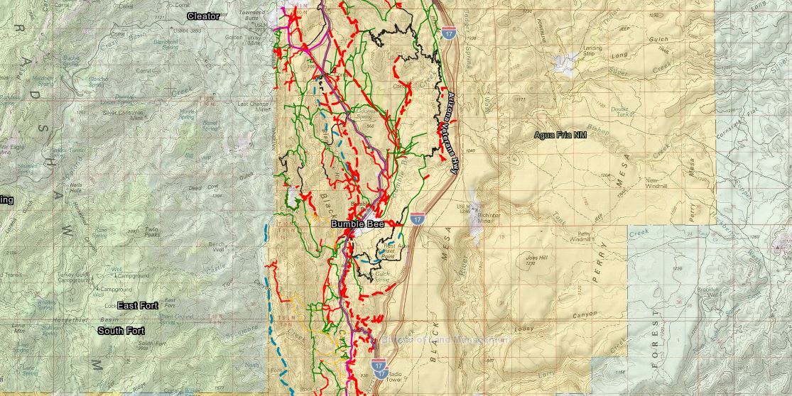
Cactus Plain
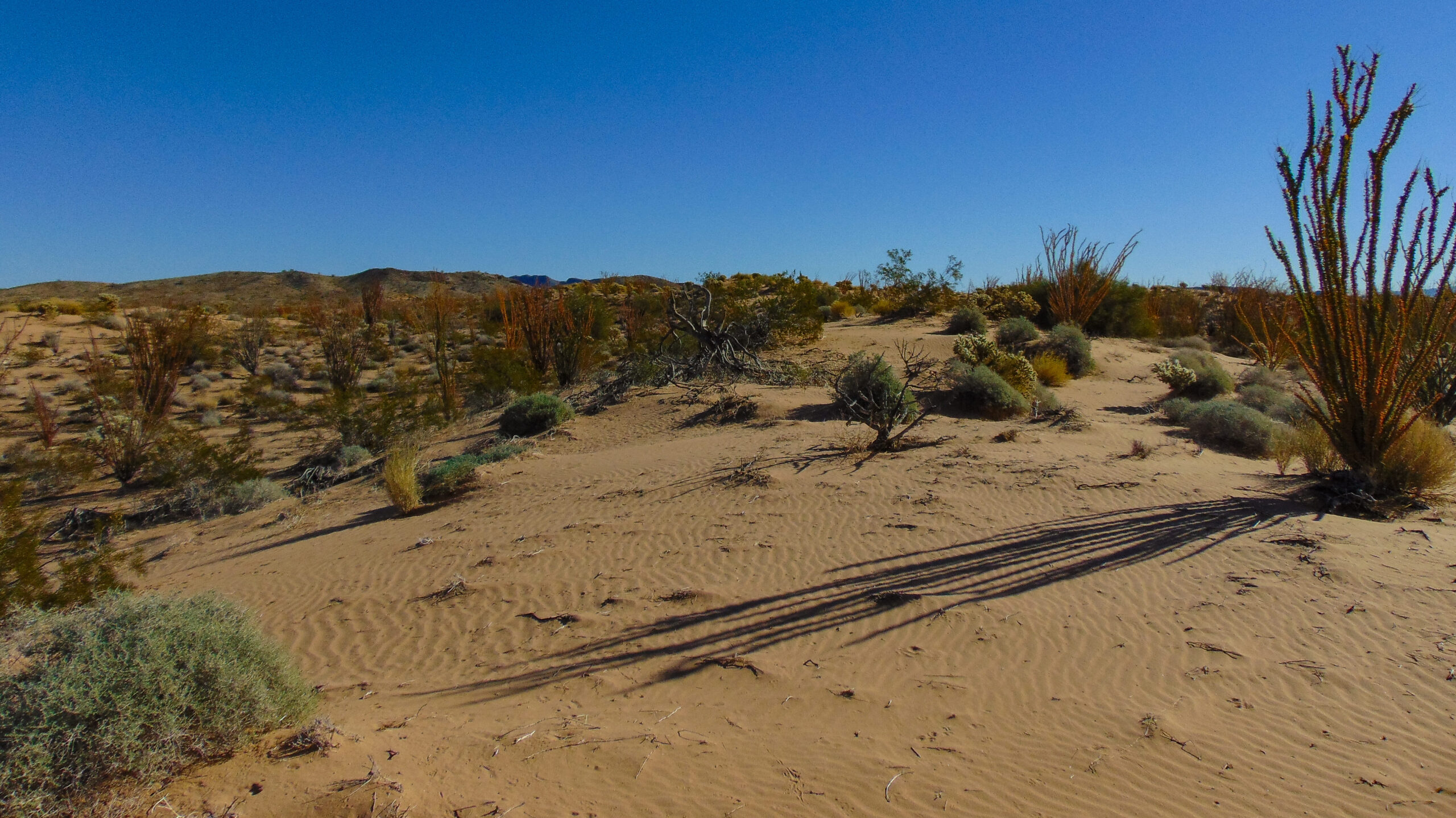
The Cactus Plain Travel Management Area is a 441,749-acre swath of land just east of the City of Parker, Arizona, and is home to a massive motorized culture that hosts multiple desert races every year such as the Parker 400. In the area, is the Parker Desert Bar, Planet Ranch, Swansea, Cactus Plain Sand Dunes, Bill Williams National Wildlife Refuge, Bill Williams Overlook, and multiple other popular attraction on public lands.
A small portion of the Northern end of the Bouse Travel Management area is located in Mohave County. An even smaller portion in the northern end is located in California. A majority of the southern two-thirds is located in La Paz County.
The Bureau has identified two areas with wilderness characteristics that enclose 31,275 acres of public land inside a fictitious boundary that is closing an estimated 30 miles of existing roads. These areas are identified during land management planning and/or wilderness inventory assessments with the intent of congressional designation. These are areas that, according to the Bureau, meet the requirements of the Wilderness Act but lack a congressional designation, and therefore must be managed to preserve their wilderness characteristics.
Bouse
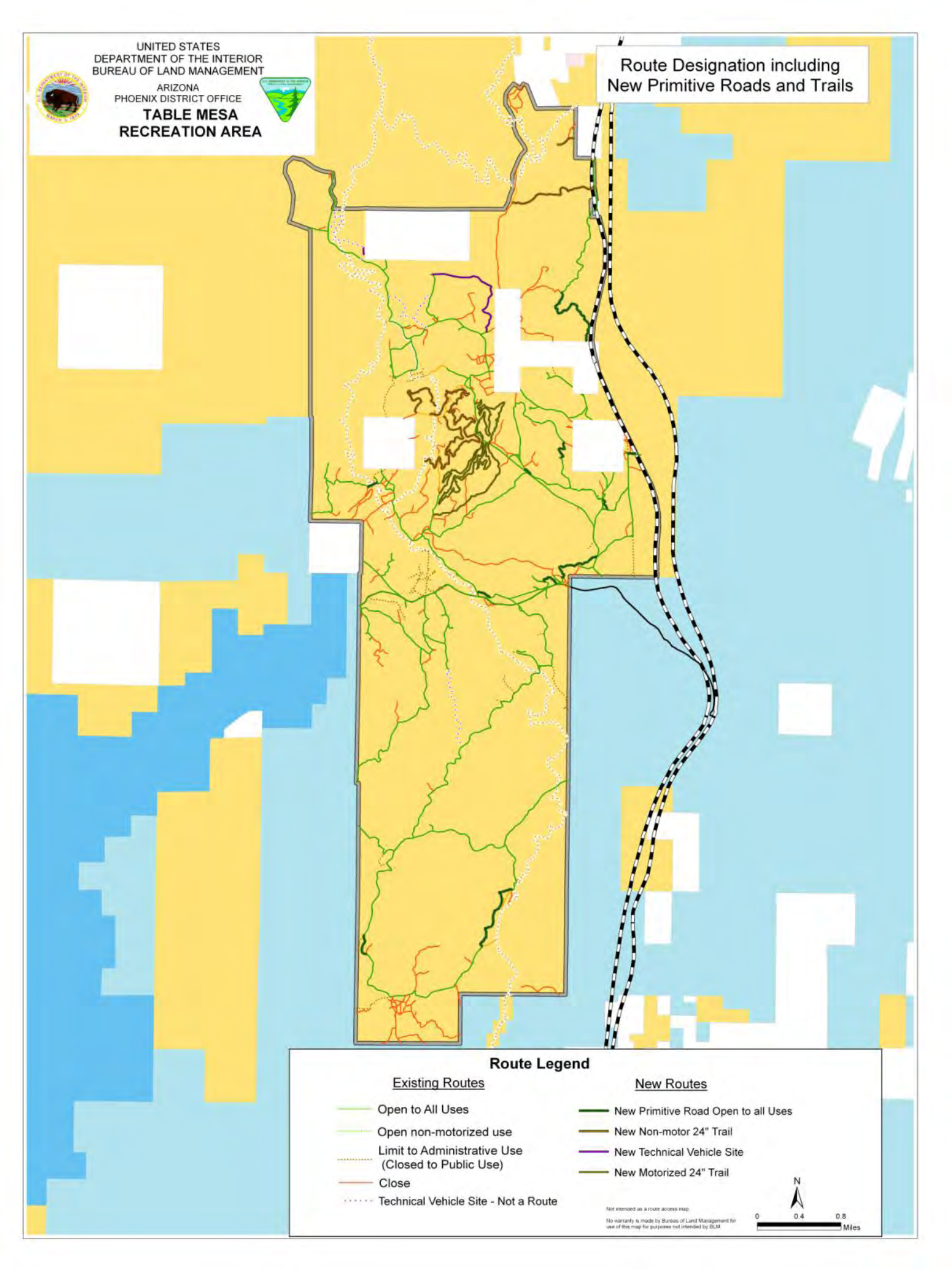
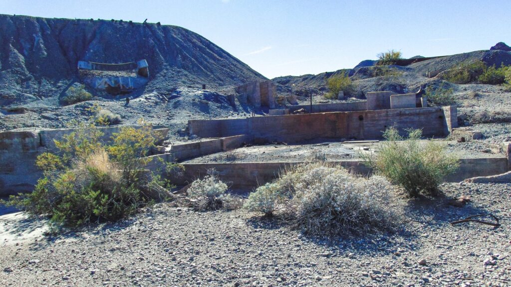
The Bouse Travel Management Area is a 342,020-acre area bound by Interstate 10 to the south and encompasses the small towns of Breana, Vicksburg, and Bouse. The Bouse area is facing the most changes with a stunning amount of roads being decommissioned on the northeastern flank of the Plamosoa Mountains, the Ranegras Plain, and the Bear Hills near Branda.
Interactive map
You can use the map below to visualize the final decision. Be sure to click on each feature to read additional information about the designation. On this map, all roads open to the public are marked in Green. The rest are limited to permitted or administrative use.
As we have discussed on many occasions, per federal and state law, roads over federal lands are a servitude by the dominant estate imposed on the servient estate. The long-standing common law principle of rights of way inherently provides a fundamental right of locomotion that is governed by the County on behalf of We The People. To close these roads requires a formal process by the County Board of Supervisors or an order of a court of competent jurisdiction where We The People are best represented.
The US Constitution limits federal executive and judicial powers by restraining legislative jurisdiction to lands ceded to the federal government by cession statutes enacted by the Arizona Legislature. State law grants proprietorial interest only legislative jurisdiction to the federal government on the Bureau of Reclamation, National Park Service, military, federal prison, and post office lands.
Please Take Action Now
Now that the Bureau has released its final decision, our only option is to pressure our local political representatives to take action and intervene. On the previous withdrawal, the Mohave County Board of Supervisors, congressional representatives, and state legislators took action on the Kingman Travel Management Plan which concurrently resulted in a successful withdrawal of this plan.
Please send your thoughts to the La Paz County Board of Supervisors and state legislative representatives. Please be respectful when asking for their assistance.